Antarctic Sea Ice in 2026: A Maximum That Was Unusually Small
NASA's October update describes a low winter maximum. Understanding the result requires attention to what was measured.
Estimated CEFR reading level: C2. Qualified scientific claims, measurement boundaries, competing comparisons and inference across a sustained argument. This is an editorial estimate, not an official certification.
Five useful words
British English pronunciation (IPA). Audio uses an available English voice on your device.
extent /ɪkˈstent/
nounThe total region meeting a stated measurement threshold.
Extent includes qualifying partly ice-covered cells.
threshold /ˈθreʃhəʊld/
nounA boundary at which something is counted or treated differently.
The analysis uses a 15 percent threshold.
provisional /prəˈvɪʒənəl/
adjectiveSubject to confirmation or revision.
The first estimate was provisional.
interchangeable /ˌɪntəˈtʃeɪndʒəbəl/
adjectiveAble to replace each other without changing the relevant meaning.
Area and volume are not interchangeable.
qualify /ˈkwɒlɪfaɪ/
verbTo limit a statement so that it reflects its conditions.
The authors qualify the estimate rather than claim certainty.
The story
A low point within a seasonal high
NASA's 12 October 2026 update reports that Antarctic sea ice likely reached its annual maximum on 14 September, at an estimated 17.59 million square kilometres. That would be the third-lowest maximum in the satellite record. It can be both a maximum and unusually low: it was the year's greatest extent, but smaller than the peaks in most other recorded years.
Antarctica is a continent surrounded by ocean. Sea ice expands during the Southern Hemisphere winter and retreats as temperatures rise. A report about its September maximum therefore describes the end of a growth season, rather than claiming that ice has stopped responding to the seasons.
Extent is a defined measure
The reported number is extent, not an inventory of solid ice. Satellite data are divided into grid cells. In the usual calculation, a cell counts towards extent when at least 15 percent is ice-covered. The whole qualifying cell contributes to the extent total, even when open water remains inside it.
Area and volume measure different aspects of the ice. Area accounts for the ice-covered part of each qualifying cell; volume also requires its thickness. Extent instead counts the whole cell once it passes the concentration threshold. The same region can therefore have a large extent while containing open water, and none of those measures alone establishes how thick the ice is.
Using a consistent threshold allows comparisons across the record. Changing it could change which cells count towards the total, even without a physical change in the ice. The definition is therefore part of the result, rather than a detail that can be omitted when comparing different years or datasets.
A snapshot cannot describe every change
Imagine two hypothetical gardens with the same outer boundary. One has dense planting, the other scattered plants. Their boundaries match without their contents being identical. This original analogy is limited: it explains a measurement distinction, not how satellite sensors work or why Antarctic ice changed.
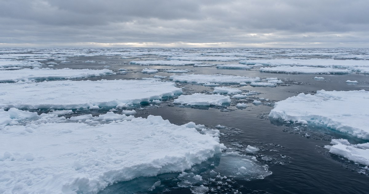
Likewise, a photograph of floes can communicate a setting without establishing continent-wide extent. That calculation depends on systematic observation. The representative image accompanying this lesson supplies no numerical evidence, and neither the amount of white visible nor the image's apparent realism should be mistaken for a measurement.
What the rank does and does not settle
The September NSIDC release described the peak as provisional because fluctuations near the seasonal turning point can complicate identification of the final maximum. NASA's October account also uses qualified language. Such wording indicates the status of an estimate; removing it would make the claim stronger than its source.
The third-lowest ranking compares annual maxima using a particular metric and satellite record. It does not establish ice thickness or explain the contribution of every process affecting that season. Researchers would need further observations and analysis to answer those different questions, even though the ranking itself remains informative.
The headline is easier to interpret when its comparison is explicit: Antarctic sea ice, at its seasonal maximum, measured by extent and compared with earlier annual maxima. The estimate also retains its qualified status. Keeping those details does not diminish the result. It tells readers what the evidence establishes and what subsequent measurements might confirm or revise. Extent, area and volume are not interchangeable.
Read the measurement precisely
| Measure | Reported value and context |
|---|---|
| Estimated peak date | 14 September 2026 Likely annual maximum, as described by NASA on 12 October. |
| Extent | 17.59 million square kilometres Ocean grid cells qualifying for the extent calculation; not continuous solid ice. |
| Rank | Third-lowest annual maximum Comparison with annual maxima in the satellite record. |
Three questions
Try answering before you open the answer. You can use your own words.
- How can a seasonal maximum also be unusually low?
Show answer
Maximum compares dates within the year; the low ranking compares that year's peak with peaks in other years.
- Why does 17.59 million square kilometres not mean continuous solid ice over that entire region?
Show answer
Extent counts whole grid cells meeting an ice-concentration threshold. A qualifying cell can still contain open water.
- What can the generated photograph establish about the 2026 extent?
Show answer
Nothing numerical. It illustrates a representative setting; the estimate depends on satellite measurements, not the generated scene.
Let's talk about it
A few ideas to chat about - pick any that interest you.
- Have you seen a headline that made more sense once you knew what was being compared?
- Where do you find a simple cutoff useful, even though it leaves out some detail?
- What wording would make a provisional result feel informative to you without sounding certain?
- What would you like a sea-ice graphic to show alongside its most striking number?
- How do you feel about following a slow environmental trend when daily news focuses on records?
Practise a useful pattern
Use whereas, does not necessarily imply and provided that to distinguish metrics and limit conclusions. Write a three-sentence interpretation of the result using all three expressions.
Frequently asked questions
What was the estimated 2026 Antarctic sea-ice maximum?
NASA reported about 17.59 million square kilometres, likely reached on 14 September and ranked third-lowest among annual maxima in the satellite record.
Does sea-ice extent measure thickness?
No. Extent counts the region meeting an ice-concentration threshold; thickness is needed to estimate volume.
Sources and editorial notes
Original learning article by Poly-Puff, written from the factual sources below. Sources checked on 12 October 2026. The artwork and learning activities were created for this article.
The headline concerns Antarctic annual maximum extent, not the Arctic minimum, the all-time daily minimum or ice-sheet volume. The rank is limited to the satellite record. The garden analogy and measurement-reading advice are editorial, not a new attribution study.